Roland Grillmayer
Environment Agency Austria (EAA)
Research Projects

Main goal of the project is the revision of the existing mapping from the ecological network in Austria, which was be done by Köhler/Grillmayer 2005 (see also: http://corp.at/archive/corp2007_GRILLMAYER.pdf). The existence on actual and homogenous Austrian wide ecological network dataset is an essential requirement for the development of protection strategies.
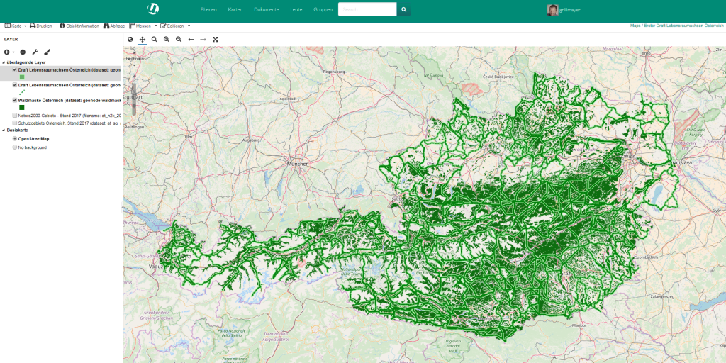
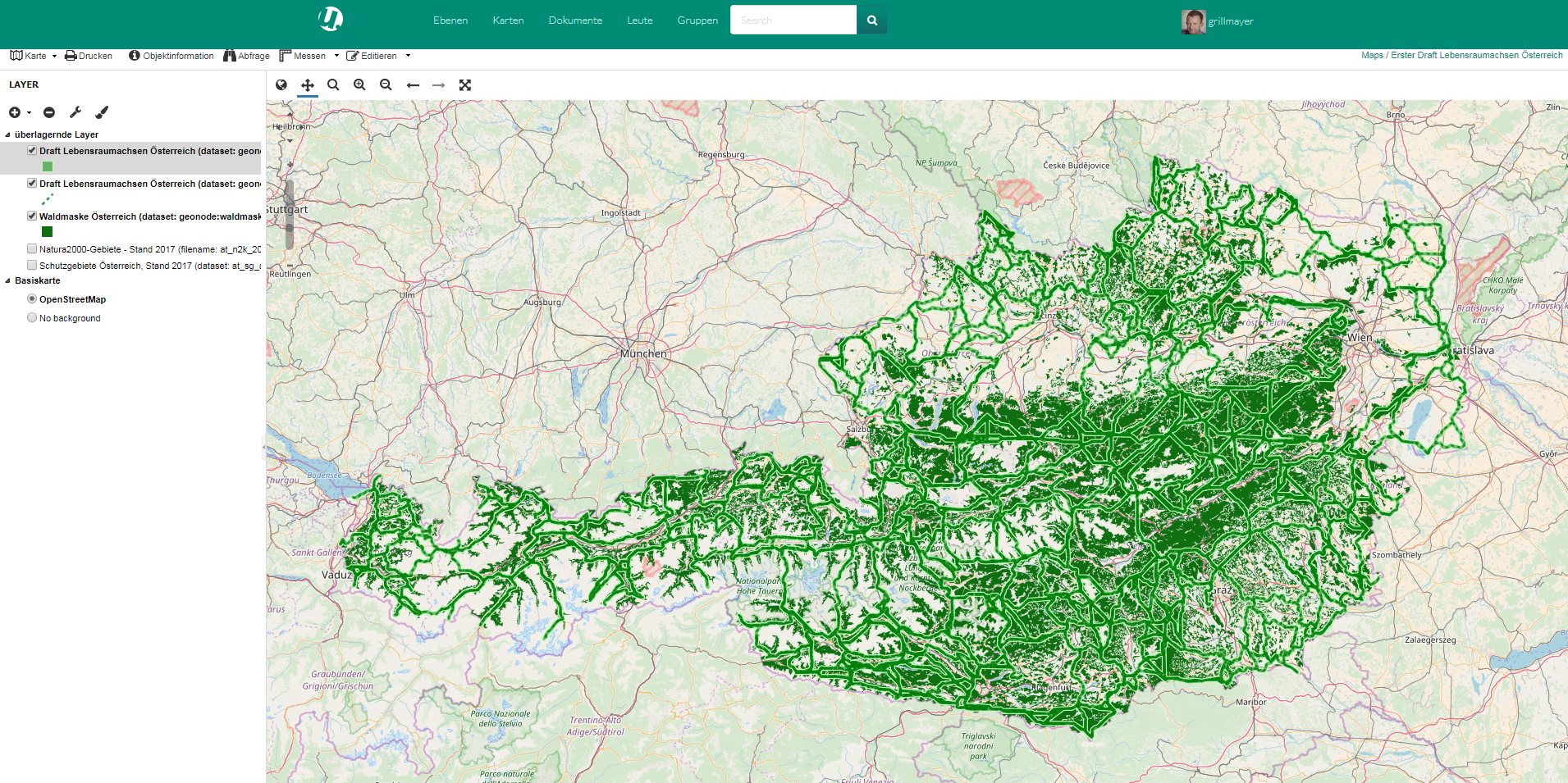
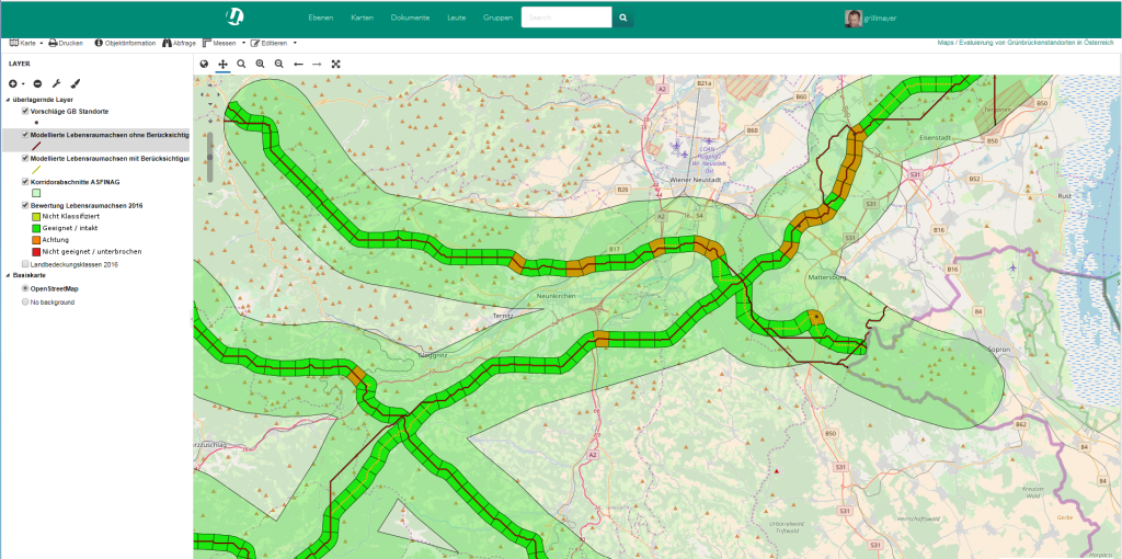
First draft of the revised habitat network mapping
Map available: http://136.243.174.51/maps/251/viewFurthermore awareness-raising actions are planned to bring the topic of ecological network closer to the general public as well as decision-makers. Extensive public relations work is an essential prerequisite to increase accaptance of conservation measures for the Austria- ecological network.

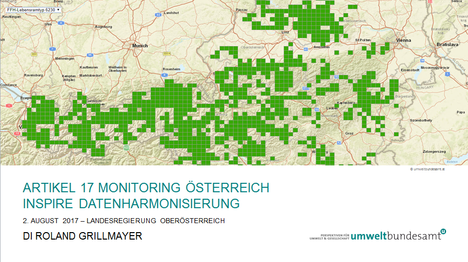
The Austrian Federal Ministry of Agriculture, Forestry, Environment and Water Management (BMLFUW) established an assistance contact point to support the implementation of the INSPIRE directive in Austria. Roland Grillmayer is the responsible people for all questions according INSPIRE data harmonization issues. The main activities are of the subgroup INSPIRE Data Harmonization are:
– Testing of different open source server software solutions
– Technical support for the provincial governments
– Support for the provincial governments within the harmonization process of all annex I themes
– Development of hands on sessions for the harmonization of different INSPIRE data specification for HALE and FME
– Introduction in Geography Markup Language
Further Information is available in: https://assistenzstelle.inspire.gv.at/datenharmonisierung
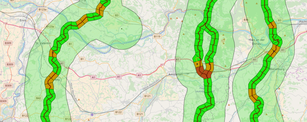
The study examined the suitability of 20 planned green bridge sites. Therefore the course of the green corridors before and behind the planned green bridges sites were identified and analyzed regarding their permeability for large mammals. The course and evaluation of the corridors permeability was mapped and visualized using GIS-Technologies. Results of the Study are available @ASFING Austria.
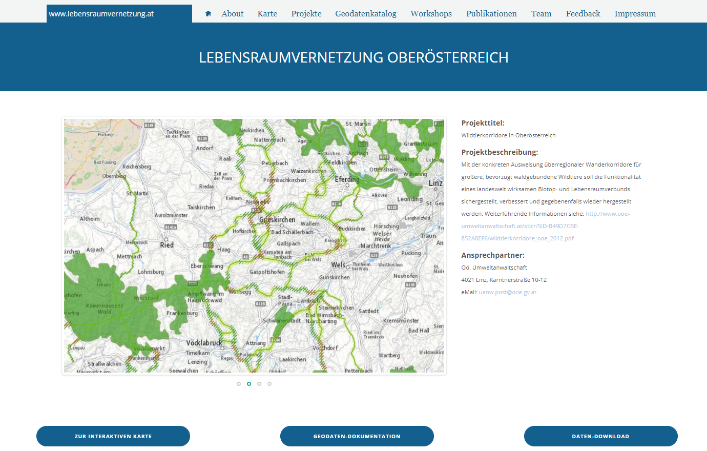
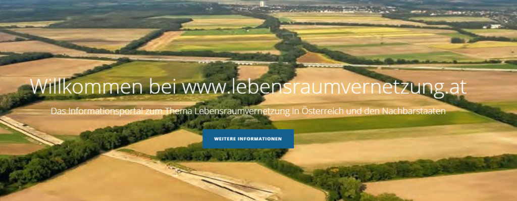 The Austrian Federal Ministry of Agriculture, Forestry, Environment and Water Management (BMLFUW) commissioned the Environment Agency Austria (Umweltbundesamt) and the Office of Wildlife Ecology and Forestry (Büro für Wildökologie und Forstwirtschaft) with the exploration of the status quo of ecological networks in Austria and its neighboring countries, with the establishment of a prototypical web portal (www.lebensraumvernetzung.at) and with the analysis of the role of ecological compensation areas in ecological networks and habitat defragmentation.
 A prototypical web portal that has been established within this project is providing existing basic data and further information on the issues. See also: www.lebensraumvernetzung.at
 Austria and many other European countries can build on a long experience of successful activities on land cover and land use (LC/LU) monitoring. However, in Austria these datasets have been produced with different standards, lack comparability or are in most cases outdated. Stakeholders from public administrations and the private sector demand upto date, more detailed, and harmonised LC/LU information, in order to fulfil therequired reporting obligations arising from new European directives and regional / national legislation. In order to overcome the shortcomings of existing LC/LU data sets for regional, national as well as European management and reporting requirements, the project Land Information System Austria (LISA) was initated by GeoVille together with other Austrian stakeholders. The project is funded by the Austrian Space ApplicationProgram (ASAP), and was successfully kicked off on June 15th in Vienna at the Austrian Institute of Technology.
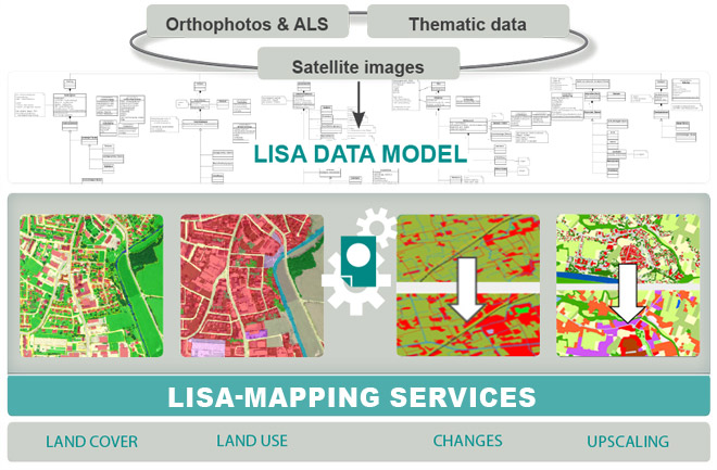 Participation of the University of Applied Sciences Wiener Neustatd within the LISA I Project: In a close cooperation with the University of Technology Graz, Institute of GEOinformation, our part within this project was the development of a conceputal data model for land use and land cover which covers most of the needs of the different stakeholders in austria.
Our part within the project was the conceptual design of all GIS components for the distribution of the results in different client applications. After the scientific processer classified an earth observation image which has some flooded areas within, a notification is send to cartographic processer. Within this cartographic processer different OGC services are registered and each flooded scene is registered in a geographic metadata catalogue. Also a tiled map cache is automatically computed. The results are available on different clients (mobile-, web- and professional GIS client).
Figure 1: FAAPS Architecture
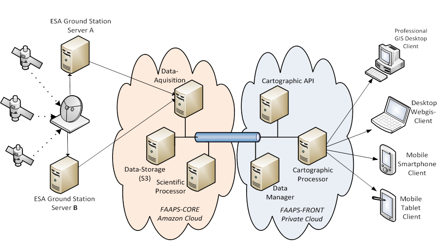
Figure 2: FAAPS Web-Client
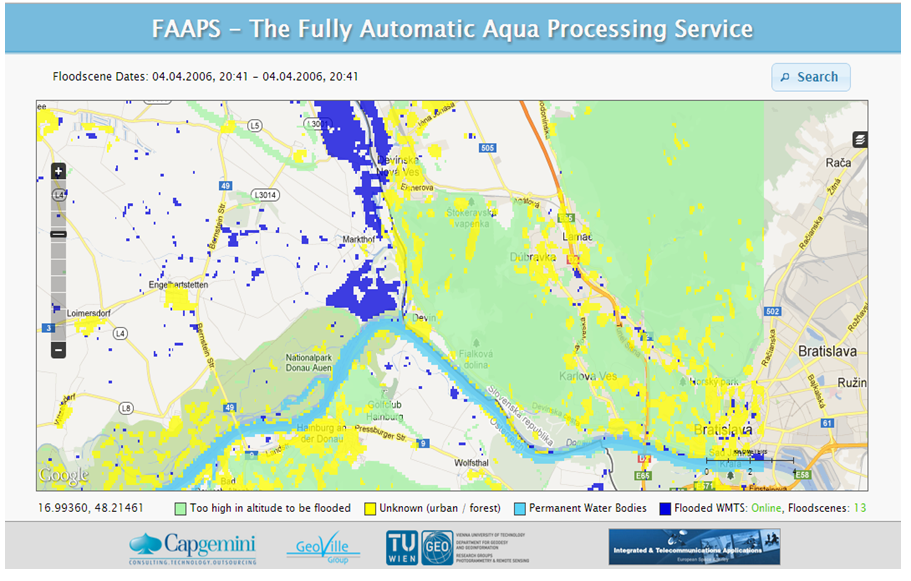
See further Information: http://artes-apps.esa.int/projects/faaps
Available Clients:
Desktop Client: http://desktop.faaps.eu
Mobile Client: http://mobile.faaps.eu/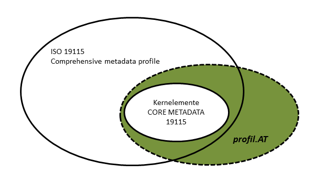
Within the project an ISO 19115 compliant metadata profile for Austria was developed. Beside all for this topic relevant ISO standards also all specifications of the INSPIRE directives were considered. The profil.at is at the moment in revision and will be available at the mid of 2015 as austrian standard ON2270 – profil.at – Version 3.0.
More information see also on my publication